

Today I would like to draw your attention to a very useful function of Google Earth program that can be applied to locating your ancestors’ land or houses with the use of scans of 19th centuries cadastral maps, that can be found in Przemysl State Archive and are available here: https://www.szukajwarchiwach.gov.pl/en/zespol/-/zespol/125896
What you need to do first is download Google Earth program. Then you need to use an image of cadastral map as an overlay. The instruction how to do it is here: https://support.google.com/earth/answer/148099?hl=en
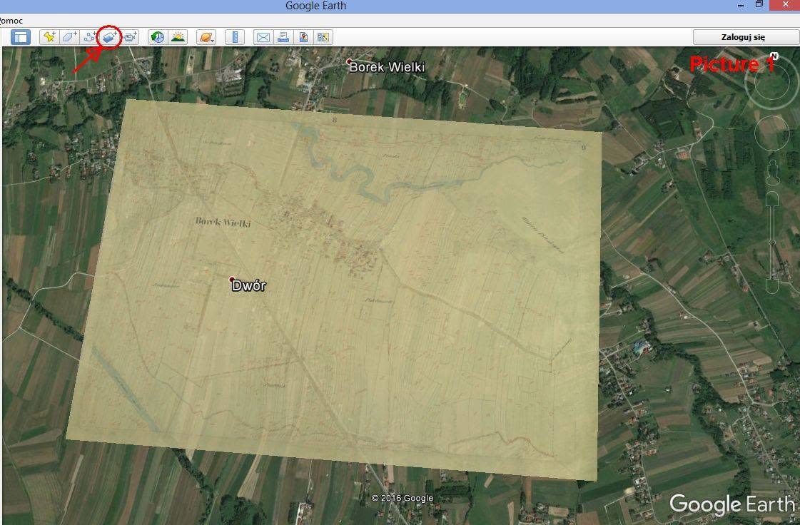
On Picture 1 you can see how it looks like. It is possible to change the level of transparancy of the overlay which allows you to put exactly the image on the correct place. In order to place it correctly you can use the roads or rivers which obviously has been in the same place for centuries. This function is really useful while being in Poland and searching for the place where ancestors lived.