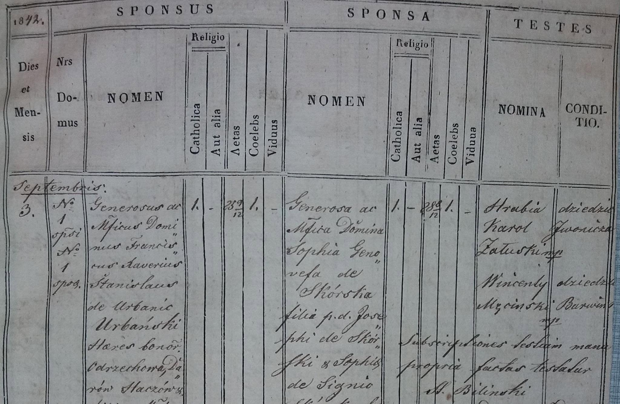


Google Earth & Old maps
Today I would like to draw your attention to a very useful function of Google Earth program that can be applied to locating your ancestors’ land or houses with the use of scans of 19th centuries cadastral maps, that can be found in Przemysl State Archive and are available here: https://www.szukajwarchiwach.gov.pl/en/zespol/-/zespol/125896
What you need to do first is download Google Earth program. Then you need to use an image of cadastral map as an overlay. The instruction how to do it is here: https://support.google.com/earth/answer/148099?hl=en
On Picture 1 you can see how it looks like. It is possible to change the level of transparancy of the overlay which allows you to put exactly the image on the correct place. In order to place it correctly you can use the roads or rivers which obviously has been in the same place for centuries. This function is really useful while being in Poland and searching for the place where ancestors lived.
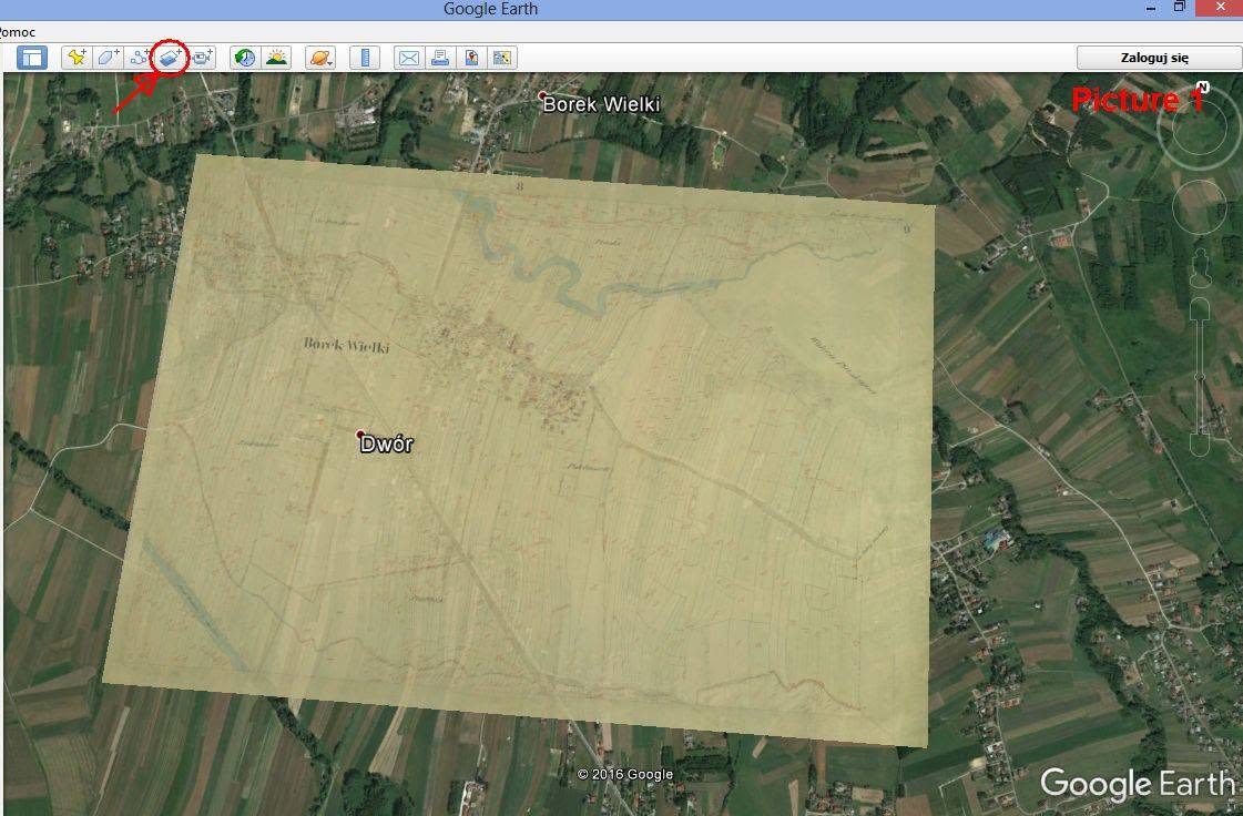
Nobility records
In 19th century the social status, being part of nobility or being a prominent member of the society was always reflected in the metrical books. In the photo attached there is a record from parish of Rymanow in Przemysl Diocese which shows the of marriage of Franciscus Xaverius Stanislaus Urbanski and Sophia Genovefa Skórska in 1842. As you can see their names are preceded by the titles “Generosus ac Magnificus Dominus” and “Generosa ac Magnifica Domina” which is rather difficult to translate and means more or less “Great Lord/Lady of noble birth” Then after the name there is information about towns he owned “Heres bonorum Odrzechowa, Darów, Haczów “